| |
|
First,
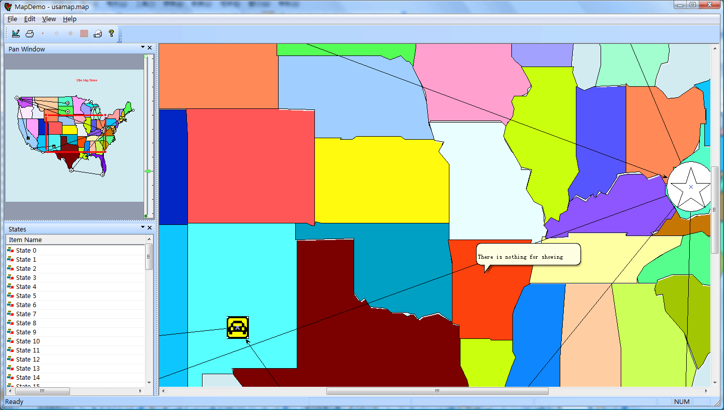
the geographic information system GIS:
 .
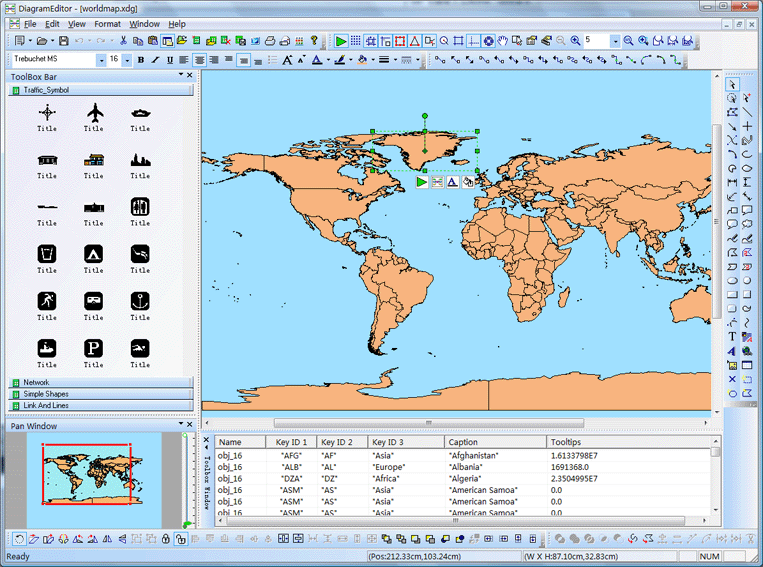
E-XD++ provides the most comprehensive vector
graphics editing capabilities, which is essential
for the development of any GIS system.
You
can use this part of the functionality into GIS
system, will save you a lot of development time.
.
E-XD++ provides the most comprehensive vector
graphics editing capabilities, which is essential
for the development of any GIS system.
You
can use this part of the functionality into GIS
system, will save you a lot of development time.
.
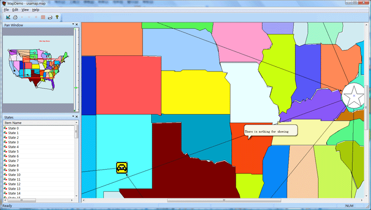
Support the canvas with arbitrary scaling.
.
Support the canvas translation, mouse crawling
through the canvas horizontal or vertical direction.
.
Support the small preview window, and can be
adjusted through the canvas of rectangular window
viewing area location.
.
Support any polygon complex operations, including
intersection, subtraction, phase and, to take over
more operations.
.
By shapedesigner program, you can quickly create any
desired map feature.
.
Statistical tables and charts support the histogram,
pie chart, etc., can be more extensive statistical
analysis of the report.
.
Ocx controls the same functions available, providing
rapid web deployment.
.
All the features of all the source code is made
using VC ++, and provides all the source code.
|
And
|
|
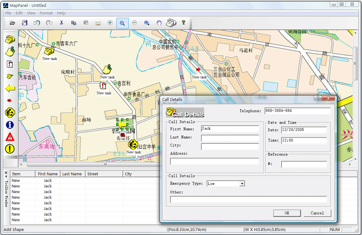
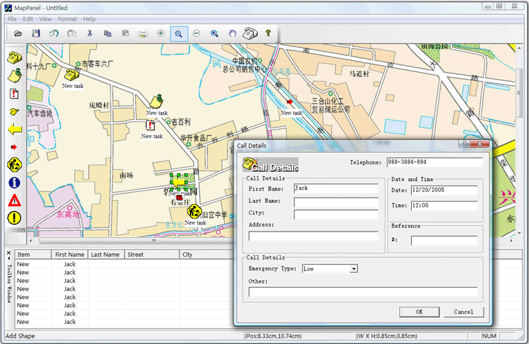
Second,
military, energy map:
.
Compound shapedesigner by importing svg or graphic
design program, you can quickly create a variety of
map graphics.
.
To provide background and prospects of dual-mode
editor, the map image files can be placed directly
into the background.
.
All polygons or graphics can be any appropriate
geometry independent mouse click, you can run the
page to jump, run programs, send e-mail, display
information, and respond to events large and
extensive.
.
The system design model and operation mode of the
built-in design mode, you can complete the
development of map making, in the run mode, the
default response to various events.
Time
can also be developed directly in the development of
two programs, a direct work in design mode, the
other directly to work in run mode.
.
All are free to switch the graphics state can be
used for military simulation field development.
.
All of the code were made using C ++ development,
with the corresponding fast speed.
.
Products Canvas size can be arbitrarily set to
support the pan, zoom, preview window, microfilm and
other functions.
.
Performance of very high place in the same canvas at
the same time tens of thousands of graphics
operations.
.
Product features are very stable, has to include the
British Rolls - Royce, France ALSTON, U.S. SIM and
many other aviation and military giant years of use.
. Support SVG Import and Export.
. Support DXF Import and Export.
. Support ArcGIS shape Importing.
. Support XML Loading and Saving.
. Support Microsoft Access (*.MDB), SQL Server, etc.
. Support 1,000 printer drivers.
. Full tested on all Visual Studios (From Visual Studio 6.0 to Visual Studio 2025).
. Full tested on all Windows (32 bits to 64 bits).
. Can be used on Windows CE.
.
Products provide all the 100% VC ++ source code
designed to make your own products directly to the
core of the technology, there are no security
issues.
As
shown below:
More
than 500 thousands lines "all
carefully designed and rigorously tested"
C/C++/.NET source codes, all complete source
codes is shipped without
any reservations!
Provide
more than 400 C + + extension class, more than 500 thousands lines of effective VC++ / MFC source code, more than 70
ready to use solution's source code, complete and
detailed online help system and user documentation,
supporting development tools designed!
Powerful,
flexible and easy to use graphical visualization of
source code libraries.
Powerful
and flexible components to create a variety of charts to meet
your needs.
Product
design specifications, it is easy to use, in just a
few days can be designed according to your needs
products.
We
provide complete support for products, download the
trial.
Feature-rich.
Ultra-versatile,
such as automatic layout, multi-level collapsible
subgraph, cell connection point, XML, DXF, SHP, SVG,
etc., can help you quickly create complex and
flexible chart.
Supports
a number of events: such as click, double click,
hover, select, rubber band select, copy, delete,
resize and move the support.
Support
the most complex operations: such as drag and drop,
unlimited undo / redo and clipboard operations and
so on.
Save
time and money to obtain reliability.
A
picture is worth a thousand words, E-XD++ offer more
than 500 thousands lines of well-designed and
well-tested C/C + +/.NET source code!
Development
takes years, thousands of customers worldwide
validation, can save you a lot of development time
and money!
Try
it now!
Do
not just listen to us say it a try!
Our
free trial includes all you need to prototype your
application.
Free
technical support.
Highly
recommended (new GisEditor, GisViewer, GIS OCX
integrated comprehensive solution):
 Products
 Download this
solution
Download this
solution

The official
version of the E-XD++ component library visual
graphics solutions for enterprise version provides
all the source code, click the button below to order
from UCanCode
:

Contact UCanCode Software
To buy the source code or learn more about with:
 GIS and SCADA,
SCADA Software With GIS, Real - Time Software with GIS, Source Code solution for C/C++, .NET GIS and SCADA,
SCADA Software With GIS, Real - Time Software with GIS, Source Code solution for C/C++, .NET
|